Showing posts with label Gold. Show all posts

Saturday, October 1, 2016

Three Trees on the Trail


Today I hiked Euchre Bar Trail, my goal the Southern Cross Mine, but when I reached the third downed tree, I decided to turn around.

No other vehicles were at the Iron Point trailhead when I arrived at 8:15. The clear skies and cool temperatures promised perfect hiking weather. In my Osprey pack were a fleece jacket, knit cap, and fire making items, to keep me through a chilly night in the deep canyon should circumstances dictate - a twisted ankle or being half-eaten by a mountain lion or such. I've never encountered another hiker beyond the bridge, and didn't expect to see one today. I wound down the steep trail. A westbound Union Pacific freight train some one thousand feet above me broke the silence. Soon I could hear the roar of the river. I reached the footbridge over the North Fork American River. There was no wind, and the surface of the water was like glass.

Iron Point Trailhead


Some twenty minutes after crossing the river, I reached a downed pine tree with a trunk diameter of about thirty inches. The needles were still green. The roots, now reaching into the air, had taken up large chunks of slate. The slate is part of the Shoo Fly complex, the oldest rocks of the Sierra Nevada, and in the slate can be found veins of quartz containing gold. I looked for quartz in this exposed slate, but saw none. I wound around the roots, crawled over the trunk, and continued on my hike.


I reached the second fallen tree, which I had seen on my last hike here (2014, I think). The bark had fallen off the trunk. I crawled over the trunk and continued on.

This section of trail is very beautiful, with the several emerald-green pools below. I passed a pile of stones at a level spot overlooking the river. I'm sure the Forty Niners put up these stones for a cabin or tent site during the Gold Rush. About the ground are chunks of quartz the miners pulled out of the hillsides. The rocks are now covered in moss.


A bit later I reached the third downed tree, too large to crawl over. Others had made a path up and over the roots. I looked at this obstacle and considered my situation. I was by myself, the mine was a good half mile away, and there might be more downed trees. If I needed to reach the mine, I could try the route from Foresthill Divide through Dorer Ranch. I considered everything, and decided to have lunch at my gold panning spot.


View from the trail to my gold panning spot

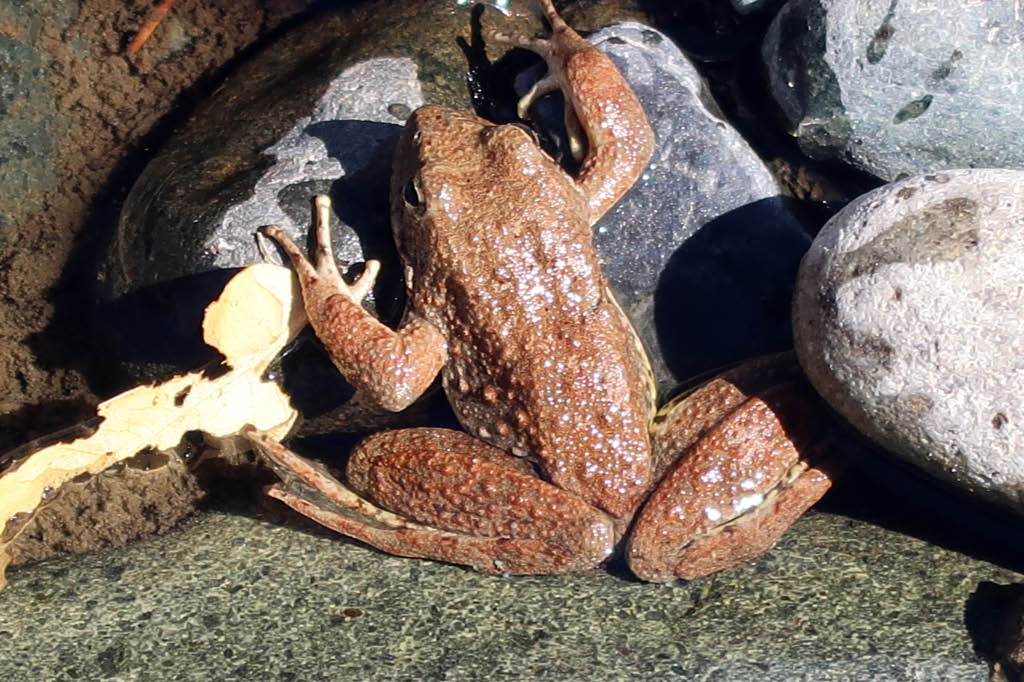
The river was at the lowest level I had ever seen, a good two feet below normal judging from the moss on the rocks. I'll return soon with a bucket, shovel, and gold pan, but today I simply enjoyed the scenery. Small trout rose to the surface. Frogs hopped about. During spring snow melts, in years without drought, I've seen the river running so hard that getting caught in the current meant certain death, and I've heard the clunk of boulders the size of basketballs moving downstream. But today I could have crossed the river without getting my knees wet. I finished my lunch and poked around the bar. People camp here. Someone had left behind a piece of quartz taken from a nearby vein. I'm sure they had taken several pieces, but left this one as it contained so little gold it was not worth carrying out of the canyon. I left the rock, so that others could find it and see the gold. Also at the bar was the rusted wheel of an ore cart from some mine around here.



Gold-bearing quartz

I wonder if this is where Thomas Lane met his end. From the Daily Alta California of July 2, 1855:


I made the 1800 foot ascent without needing to stop and rest. I did briefly talk with two men in their thirties hiking down to the river, the only others I saw on the trail this day. They didn't intend to go beyond the bridge. Few people do. Here may be the reason the trail from Iron Point to the river is well maintained, while the section from the river to Dorer Ranch is blocked with downed trees - it's a matter of use. Or maybe the Forest Service doesn't have the staffing or funds to remove those large trees. (The Forest Service website says that no trail maintenance has been done since 2013.) Perhaps it's intentional neglect. This is a designated Wild and Scenic River, and since few use the section of trail, why not let it revert to its wild state?

Friday, July 17, 2015

The Empire Mine


Beneath Grass Valley is a single network of mine passageways totaling 367 miles in length.

The Empire Mine opened in 1850, and over the years it acquired the North Star Mine and other mines, incorporating them into its network. The Empire was renowned for its important inventions and improvements in mining and milling equipment, and it had a respectable safety record, with only 26 deaths in its history. Engineers from other mines came to The Empire to study its operations. The mine closed in 1956 not because the gold ran out, but because it was no longer profitable to extract. The pumps were turned off and water filled the passageways.

The gold taken would have filled a seven foot cube. An average of one-half ounce of gold was taken from each ton of ore extracted. The Empire produced $130 million in gold, making it the richest of all California mines. (Next-richest was nearby Idaho-Maryland Group in Grass Valley, with $70 million.) The years 1929 to 1940 were very productive for The Empire, with 1,074,284 ounces of gold taken. Operations were suspended during World War II when gold mining was deemed unessential to the war effort.

The state acquired the property in 1975 and turned it into a park. Although the owners had sold off much equipment following the closure of the mine, some equipment and many of the buildings remained, giving the public a good understanding of California's mining operations. As for those 367 miles of passageways, everything below 150 feet is flooded, and it is unlikely anyone will go down there again.

Travel Tip: If you're in Grass Valley and in need of lunch, I recommend Christopher's Old World Deli at 206 Main Street. The food is great, the prices are reasonable, and the staff is very friendly. When the cashier told me when I purchased the $4 pint of 'Ol Republic porter beer that there would be one free refill. I turned to my wife and informed her she would be driving.

Sunday, October 6, 2013

Euchre Bar Trail and Southern Cross Mine


I had wanted to hike both the Euchre Bar Trail and American Eagle Trail, from Iron Point to the American Eagle Mine, but I got distracted and poked around too long at the Southern Cross Mine and what remained of its stamp mill, and I got behind schedule. When I reached Humbug Bar, where the two trails meet, I realized continuing to the American Eagle Mine would cut it close for daylight on the return hike. Since I was hiking alone, I figured it best to turn around.

No other vehicles were at Iron Point when I arrived. I gathered my gear and commenced the hike. I reached the footbridge at Euchre Bar and crossed the North Fork American River. After a short elevation gain, the trail largely parallels the river. I would see no others until the return hike.


Mining activities from the Gold Rush, and in the late 19th and early 20th Centuries, left their mark in the canyon. Euchre Bar Trail is the main trail, but there are other mining trails not on the topographical maps. These are seldom used and in some cases much overgrown. There are terraces - level spots dug into the hillsides by the miners for their camps. In these terraces is found debris such as broken glass, shards from broken pots and dishes, and old nails. At one terrace, someone with a metal detector had dug in several spots. Many people with metal detectors have been there before him. The trail passes a water ditch, built to send water to mining sites.

From the trail, one can see down to a few pieces of equipment from the Southern Cross Mine. There's a trail leading to the site, but I never took the time to go down it. Until today.

Made by Risdon Iron Works, San Francisco, CA

The claim plat for The Southern Cross Gold Mining Company shows that gold was discovered here on October 6, 1884. This was 129 years to the day before my hike.


The Mining and Scientific Press of August 27, 1904 has an article discussing the Southern Cross Mine, including a photograph of the power house. It mentions the 10 stamp mill, the remains which I poked around. The heavy equipment had been hauled 35 miles from Colfax over a wagon road, and then dragged down a 2.5 mile slide from the ridge above to the mine. The river was dammed 2600 feet above the mouth of the tunnel by a timber and stone dam 35 feet high. This might be where the massive Penstock electrical generator now rests.

By 1917, however, the mill had burned and the mine was idle. This is from Mines and Mineral Resources of the Counties of El Dorado, Placer, Sacramento, and Yuba. (1917)

It's amazing how much the forest has recovered from those days. About a century ago, the canyon had active mines with dams and generators and stamp mills. Then the mines closed and the buildings burned or were torn down. Today only the metal remnants lie amidst the trees and brush.


The mines shut down when it was no longer profitable to extract the gold. But there's still plenty of gold inside the hills. The U.S. Geological Survey Professional Paper, Issue 1300, Part 1 (1984) states:

Based on past production and the geologic setting, these mines clearly define a zone of substantiated mineral-resource potential for gold and silver. It is estimated that 1.4 million tons of demonstrated lode resources averaging 0.04 to 0.22 oz of gold per ton occur at or near the Rawhide, Black Hawk, and Southern Cross Mines...

At today's gold price, that would equate to between $74,138,400 and $407,761,200 in gold in these hills.

But environmental laws being what they are, the gold will stay in the hills.

Sunday, September 22, 2013

Very Lazy Exploratory Gold Panning Hike on Euchre Bar Trail

With the hot days of summer behind us, I was overdue for a hike down Euchre Bar Trail to my favorite gold panning spot. I arrived at Iron Point this morning. Rains the previous day had cleared the air of haze and left a light dusting of snow on the crest of the Sierra, some 25 miles to the east. Mists were rising from the canyon of the North Fork. No other vehicles were about. I would be the only person in this section of the canyon this day.

View of Giant Gap from Iron Point

I'm always awed by the view of Giant Gap from Iron Point. Back in the 1870s, after the transcontinental railroad was built, and when nearby Dutch Flat was the largest town in Placer County (due to its hydraulic mining activity), rich folks from San Francisco would take the train to Dutch Flat, to enjoy the air, and they would travel to Iron Point for a look at Giant Gap.

In case of emergency, I had my cell phone, but it would work only at the higher elevations. Same with my Kenwood TH-F6 ham radio. Deep in the canyon, surrounded by the steep hillsides, only the signal from my ACR ResQLink personal locator beacon would reach out. And even that depended on the amount of tree limbs overhead.

While still atop Iron Point, I made a radio check with my ham radio to the Sierra Foothills Amateur Radio Club 2 meter repeater in Auburn. I got a reply that my signal was weak but readable. Considering I was transmitting on five watts, and the repeater was about 27 miles to the southwest, I thought this was pretty good.

I shouldered my Osprey pack. Now I was ready to go.

My destination

The ground was a bit wet from the rain the previous day, so I had to be careful of my footing. The trail is steep, a drop of some 1,800 feet over about 1.25 miles. I find walking down a steep trail more taxing on the leg muscles than walking uphill. There's that extra bit of control needed to slow down due to gravity.

Near the bottom of the canyon, where Euchre Bar Trail connects with the North Fork North Fork Trail (an old miner's trail, now very seldom used), is the foundation of a small building that dates to the mining days of the late 1800s. Back then there was placer mining and drift mining and hard rock mining on this river and the ridge above. Miners were all about. The building that stood on this spot was a general store, a saloon, and a brothel. Besides the concrete and stone that was part of the foundation, there remains some metal objects such as pipes and cans, and broken glass, and ceramic shards from plates and such.

The history of the building was given to me by a man I met at the spot early this year. He was from nearby Alta and very familiar with the local history.

The foundation of the building

The trail continues downhill, past large boulders from a glacial moraine from the Ice Age, and then it reaches the footbridge over the North Fork American River. After crossing the footbridge, the trail climbs about eighty feet, and then largely remains level, as it parallels the river. This is where Euchre Bar Trail is at its glory. There is a roar from the river below. The forest canopy largely blocks the sunlight. The forest has a rich smell. There is the solitude. I wonder if around the bend ahead is a black bear walking my way.


I reached the turnoff to my gold panning spot. This hike was really exploratory in nature. I wanted to check out some different spots. I plan more trips in the weeks ahead. There is a pile of iron pipes by the river. These likely date back to the late 1800s. People hauled them all the way down here for mining operations and then apparently never used them.


My test pans showed no color, but I made the tests in spots I never worked before. I plan on more trips and I will get some gold.

This was really just a lazy day down on the North Fork. I enjoyed the fresh air and the scenery and the solitude.

I have many years of good hiking ahead of me, but the day will come when my legs won't have the strength to get me out of these canyons. Until then, I'm going to get in as many hikes as I can.

The angle of the sun meant it was time to pack it up. I gathered my gear and headed up to the trail. I reached the footbridge and looked to the water below. Several nice sized trout were lazily swimming about. I don't think many fishermen come down here.


View upstream from the bridge

From the footbridge, it was all uphill to my truck at Iron Point. I made the walk slow and steady, and I made it without stopping. Never before had I hiked out of the canyon without stopping. But then again, I was well hydrated, and I had not spent hours shoveling river gravel into buckets.

I reached my truck, and it was the only vehicle there. Just as I was ready to drive away, another vehicle arrived, but it was too late for those folks to hike to the river. I put my truck in drive and headed home.