Showing posts with label Gold Rush. Show all posts

Saturday, October 1, 2016

Three Trees on the Trail


Today I hiked Euchre Bar Trail, my goal the Southern Cross Mine, but when I reached the third downed tree, I decided to turn around.

No other vehicles were at the Iron Point trailhead when I arrived at 8:15. The clear skies and cool temperatures promised perfect hiking weather. In my Osprey pack were a fleece jacket, knit cap, and fire making items, to keep me through a chilly night in the deep canyon should circumstances dictate - a twisted ankle or being half-eaten by a mountain lion or such. I've never encountered another hiker beyond the bridge, and didn't expect to see one today. I wound down the steep trail. A westbound Union Pacific freight train some one thousand feet above me broke the silence. Soon I could hear the roar of the river. I reached the footbridge over the North Fork American River. There was no wind, and the surface of the water was like glass.

Iron Point Trailhead


Some twenty minutes after crossing the river, I reached a downed pine tree with a trunk diameter of about thirty inches. The needles were still green. The roots, now reaching into the air, had taken up large chunks of slate. The slate is part of the Shoo Fly complex, the oldest rocks of the Sierra Nevada, and in the slate can be found veins of quartz containing gold. I looked for quartz in this exposed slate, but saw none. I wound around the roots, crawled over the trunk, and continued on my hike.


I reached the second fallen tree, which I had seen on my last hike here (2014, I think). The bark had fallen off the trunk. I crawled over the trunk and continued on.

This section of trail is very beautiful, with the several emerald-green pools below. I passed a pile of stones at a level spot overlooking the river. I'm sure the Forty Niners put up these stones for a cabin or tent site during the Gold Rush. About the ground are chunks of quartz the miners pulled out of the hillsides. The rocks are now covered in moss.


A bit later I reached the third downed tree, too large to crawl over. Others had made a path up and over the roots. I looked at this obstacle and considered my situation. I was by myself, the mine was a good half mile away, and there might be more downed trees. If I needed to reach the mine, I could try the route from Foresthill Divide through Dorer Ranch. I considered everything, and decided to have lunch at my gold panning spot.


View from the trail to my gold panning spot

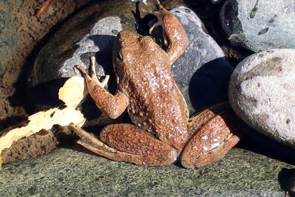
The river was at the lowest level I had ever seen, a good two feet below normal judging from the moss on the rocks. I'll return soon with a bucket, shovel, and gold pan, but today I simply enjoyed the scenery. Small trout rose to the surface. Frogs hopped about. During spring snow melts, in years without drought, I've seen the river running so hard that getting caught in the current meant certain death, and I've heard the clunk of boulders the size of basketballs moving downstream. But today I could have crossed the river without getting my knees wet. I finished my lunch and poked around the bar. People camp here. Someone had left behind a piece of quartz taken from a nearby vein. I'm sure they had taken several pieces, but left this one as it contained so little gold it was not worth carrying out of the canyon. I left the rock, so that others could find it and see the gold. Also at the bar was the rusted wheel of an ore cart from some mine around here.


Gold-bearing quartz

I wonder if this is where Thomas Lane met his end. From the Daily Alta California of July 2, 1855:


I made the 1800 foot ascent without needing to stop and rest. I did briefly talk with two men in their thirties hiking down to the river, the only others I saw on the trail this day. They didn't intend to go beyond the bridge. Few people do. Here may be the reason the trail from Iron Point to the river is well maintained, while the section from the river to Dorer Ranch is blocked with downed trees - it's a matter of use. Or maybe the Forest Service doesn't have the staffing or funds to remove those large trees. (The Forest Service website says that no trail maintenance has been done since 2013.) Perhaps it's intentional neglect. This is a designated Wild and Scenic River, and since few use the section of trail, why not let it revert to its wild state?

Tuesday, January 12, 2016

1850 Census

Along the stretch of the North Fork of the American River between Euchre Bar and Humbug Bar there is but one domicile, a house on Dorer Ranch. The Dorer family has occupied the site since the 1860s. They apparently value their privacy, for I hear that atop Foresthill Divide the gate across the dirt road that winds down to the house is kept locked. I've reached the Dorer property twice, hiking in along the river from Iron Point near Alta. Those walks on the Gold Rush-era trail were solitary, for few people venture into the deep canyons nowadays. But it wasn't always quiet down there. A bit over a century ago, the clanging from the stamp mills at the Southern Cross and Blackhawk mines reverberated throughout the canyon. A twenty-horse power gasoline engine generated electricity for the incandescent lights and telephone lines and air compressors of the Southern Cross. The greatest activity was in the early years of the Gold Rush, when miners worked the gravels. The level spots they dug into the hillsides to pitch their tents testify to their presence, and sometimes the ceramic shard of a bowl or cup may be found. As far as I know, only the Nisenan walked this area before the Gold Rush - I've found nothing of Hudson Bay trappers coming this far upriver.

Would the 1850 Federal Census show the number of miners down at the river early in the Gold Rush? Today I went to the Placer County Archives to find out. Placer County didn't exist in 1850 - it was formed in 1851 from portions of Sutter and Yuba counties. The archivist provided the microfilm and I scanned the documents for both counties. Names of Americans were listed along with their home state. Others had no name, only a listing such as Kanaka and Chinaman and Spaniard. Occupations were listed, most being Miner. But there was nothing to indicate which portions of the census were taken at the river, so we can only speculate as to how crowded it was in the canyons long ago.

Friday, July 17, 2015

The Empire Mine


Beneath Grass Valley is a single network of mine passageways totaling 367 miles in length.

The Empire Mine opened in 1850, and over the years it acquired the North Star Mine and other mines, incorporating them into its network. The Empire was renowned for its important inventions and improvements in mining and milling equipment, and it had a respectable safety record, with only 26 deaths in its history. Engineers from other mines came to The Empire to study its operations. The mine closed in 1956 not because the gold ran out, but because it was no longer profitable to extract. The pumps were turned off and water filled the passageways.

The gold taken would have filled a seven foot cube. An average of one-half ounce of gold was taken from each ton of ore extracted. The Empire produced $130 million in gold, making it the richest of all California mines. (Next-richest was nearby Idaho-Maryland Group in Grass Valley, with $70 million.) The years 1929 to 1940 were very productive for The Empire, with 1,074,284 ounces of gold taken. Operations were suspended during World War II when gold mining was deemed unessential to the war effort.

The state acquired the property in 1975 and turned it into a park. Although the owners had sold off much equipment following the closure of the mine, some equipment and many of the buildings remained, giving the public a good understanding of California's mining operations. As for those 367 miles of passageways, everything below 150 feet is flooded, and it is unlikely anyone will go down there again.

Travel Tip: If you're in Grass Valley and in need of lunch, I recommend Christopher's Old World Deli at 206 Main Street. The food is great, the prices are reasonable, and the staff is very friendly. When the cashier told me when I purchased the $4 pint of 'Ol Republic porter beer that there would be one free refill. I turned to my wife and informed her she would be driving.

Tuesday, April 14, 2015

Yankee Jim's Road

"Have I been down this road before?"

The question came to mind while braking my Ford F150 pickup truck in low gear as I wound down the narrow primitive road named Yankee Jim's. The Colfax and Forest Hill Commercial Toll Road Company carved this route through the Sierra canyons in the early 1880s. Colfax was a railroad town and Foresthill was a mining community. Yankee Jim's was a mining town on the road, near Foresthill. The toll booth at the North Fork American River crossing closed in 1906 when Placer County bought the route. The current bridge dates to 1930 and is in poor shape.

Yankee Jim, by the way, was a gold prospector and horse thief. He left his eponymous town and continued his horse thieving ways in southern California, where he ended his days at the end of a rope.

My passenger Gary is a fellow member of the Sierra Foothills Amateur Radio club. Recently finding a shared interest in gold panning, we decided to do some prospecting together, starting with today's scouting trip. Gary had last been on Yankee Jim's Road many years ago and thought it was worth a try.

Four roads go over the North Fork. The crossing furthest downstream and the most traveled is Highway 49, which follows the Mother Lode. Next is Ponderosa Road, built by the Civilian Conservation Corps during the Great Depression. Then comes Yankee Jim's Road. The fourth, higher into the Sierra, is Iowa Hill Road, built during the Gold Rush on a precipitous route, the most exciting ride in the county. Beyond that, the canyon walls become too rugged for roads, with only foot paths reaching the river, and few even then.

I've driven the other roads but I couldn't remember if I'd ever been on Yankee Jim's. It seemed familiar but I wasn't sure. The road from Colfax to the river was in good enough shape. This section was once paved but now it's gravel over a slate base. Attention is needed with all the curves. Some drivers don't pay attention and over the side they go. Rare, but it does happen: a quick Google search provided a recent account (link here) of a tow truck pulling a Honda from the North Fork just below Yankee Jim's Bridge. Since I paid attention we easily reached the old bridge without incident.

The next turn-around after the bridge was a mile and a half away. We didn't know this, nor did we know that the most interesting section of road was just ahead.

The grade increased. Clearance on both sides narrowed to a few feet. The canyon dropped steeply to Shirttail Creek some one hundred fifty feet below. These factors by themselves meant only increased attention was needed for the ascent; but, with the dirt and gravel surface slick from the rain two days before, and the road getting more uneven, the prospects for continuing in my two-wheel drive truck were not good. Should we proceed, when the road could be even worse beyond the bend? I didn't want to get stuck - the tow would cost more than what my 18-year-old truck was worth. Sliding off the road was the worst scenario: I pictured my crumpled truck resting upside down at the bottom of the ravine, with Gary and me trapped inside as the waters of Shirttail Creek filled the cab. Backing the truck one-third mile to the bridge would be slow and difficult. Right now this rugged canyon country didn't look so charming.

We decided that Gary would walk the road ahead to check conditions. He had to squeeze out of the cab, for the canyon wall partially blocked the door. We programmed a simplex frequency into our two-meter handheld radios. Gary disappeared around the bend. Reports came that the road was improving. After some ten minutes he told me to proceed, that he had reached a road crew. I started the truck, put it in low gear, released the parking brake, and gave it the gas. My truck kept its traction on the area of concern.

I reached Gary and the road crew, two men with a grader and a truck, at a bend where my truck could pass. We spoke with the two for a few minutes, and then we continued. I drove slowly over the freshly-graded dirt to maintain traction. The travel was fine. We reached Mexican Gulch, at the turnoff to Shirttail Creek Road, and worked a few pans of gravel. After finding only a few small specks of gold, nothing of interest, we continued on to Yankee Jim's. In the early years of the Gold Rush this was one of the largest communities in Placer County. Now only a few people live here. The place seemed vaguely familiar. I asked myself again if I had been up Yankee Jim's Road before. I really couldn't tell. We drove to Foresthill and exited the historic toll road.

----

That journey was on Thursday, April 9. I wanted to get a better idea of the road, one that would come only from a walk, so I returned to Yankee Jim's Road by myself on Monday, April 13.


I approached Yankee Jim's Road from the Colfax side, and parked next to where the pavement ends and the primitive road begins. The bridge was 3.5 miles away. The elevation here is 1875 feet. I started the walk down Bunch Canyon a few minutes after nine o'clock.


Posted signs tell the traveler not to stray beyond the road. Such notices in these parts, where a frontier mentality persists, are best heeded.


Reaching a long section of fence, I peered between the slats and saw an old and decrepit house below. I'm not sure if anyone lived in it.


I reached the boundary of Auburn State Recreation Area, beyond which came beautiful scenery.


The twisted and tortured rocks I passed were formed by subduction. This is the Calaveras complex. The rocks get older towards the river. I began my walk along slates from the Jurassic, passed the Gillis Hill Fault, walked by ultramafic rocks from the Triassic, and finally reached metavolcanic rocks from the Permian. Alt and Hyndman's Roadside Geology of Northern and Central California (2000) states:
The best that can be said of the Calaveras complex rocks is that they are an unholy mess, difficult to decipher in the field and impossible to describe adequately on maps or in words. The rocks include a scrambled assortment of pieces of old oceanic crust and sediments that were deposited on them, all torn up along faults, jammed into tight folds, and recrystallized into metamorphic rocks in the heat of the deep trench. Even geologists experienced in working with such rocks find it hard to stop at an outcrop and understand what they see.
Within this unholy mess formed quartz veins with gold. I passed the adits of several abandoned mines, all sealed now for safety.


More beautiful scenery. Plus, the golden poppies were in bloom.


The North Fork American River came into view.

A small landslide, likely caused by the rainstorm the previous week, partially covered the road.


I approached the bridge. A female park ranger was removing fee payments from the collection box. I reached the bridge at 11:03, after a walk of two hours. The elevation was 930 feet, so I had descended 945 feet in 3.5 miles.


After crossing the bridge I met the same grading crew from the past Thursday. They had finished their grading to the bridge and were preparing for their return to Foresthill. They remembered my truck.


I walked one-third mile to the spot where we stopped on Thursday, for Gary to get out and scout the road ahead. The coordinates were 10N 681911 4323045, elevation 1092 feet. I took a photo of the spot and the drop to the creek below.


I turned around and walked back to the truck, reaching it shortly after one o'clock. The hike had lasted four hours. I covered 7.6 miles.

I had seen only nine other people: 1) A man in his fifties on a mountain bike, and his dog, coming up from the bridge; 2) A county worker in a truck headed to the bridge; 3) A female park ranger headed to the bridge; 4 and 5) The grading crew across the bridge, with truck and grader; 6) A male park ranger approaching the bridge from Foresthill; 7) A man in a privately-owned truck approaching the bridge from Foresthill; 8 and 9) A couple in an SUV headed to the bridge from Colfax.

There's history and scenery on Yankee Jim's Road. If the road conditions are bad, there's also an interesting ride. Avoid the road after a rain due to the slick conditions. With two-wheel drive, wait until after the road graders repair all wear from the winter. Keep a close eye on the road. Pray that you don't meet an oncoming vehicle, for there are long stretches where only one vehicle can fit.

I'm looking forward to my next drive down Yankee Jim's Road to the North Fork American River, this time with my gold panning gear.

Saturday, March 21, 2015

Bok Kai Festival 2015


It was the weekend closest to the second day of the second month of the Lunar Chinese New Year. Time to head up to Marysville for the Bok Kai Festival! This was the 135th such festival, held in honor of Bok Kai Temple (built 1880) and its water god Bok Eye. The Chinese, of course, have held festivities in Marysville since their arrival in the early years of the Gold Rush. What number visit was this of mine - the fifth or sixth? I've lost count. I went inside the Taoist temple and watched the worshipers. I saw military volunteers from nearby Beale AFB carry the 175-foot dragon Hong Wan Lung along the parade route. Bok Kai Festival is at its core a religious event, but no ACLU types get into a snit about the troop involvement. After a big lunch at China Moon Restaurant, it was time to follow the lions about as they blessed the businesses. I departed Marysville to the sound of firecrackers in the distance. This was only Day One of the Festival - I've never been to Day Two, known as Bomb Day. But there's always next year.

Wednesday, February 25, 2015

The Hangman's Noose

On display in the Superior Court Historic Courthouse in Auburn is the hangman's noose that sent Stephen B. Richards to his Maker.


A plaque gives the details:
On January 11, 1884 this rope hung Steven Richards from a scaffold in the Placer County Jail Yard. At 1:15 PM Placer County Sheriff A. Huntley placed this rope around Richards' neck and carefully adjusted the noose. The trap door dropped and nineteen minutes later Steven Richards was pronounced dead. 150 people came to Auburn and witnessed the hanging, including Sheriffs Galt of El Dorado Co., Carter of Nevada Co., and Cunningham of San Joaquin Co. Richards had murdered Thomas Nichols, 27, a miner on Sunday morning, March 11, 1883, outside the American Hotel in Auburn.
A note by the noose states that Richards directed the building of the scaffold from the jail windows.

The first floor of the courthouse (completed 1898) contains museum exhibits, and court cases are still heard on the upper floors. The noose sits in an alarmed display case in the old sheriff's office in Room 103, which contains furniture and books and firearms from a century ago. The Placer County Jail Register rests on the counter-top, its pages turned in synch with the current date. On my February 25, 2015 visit the Register was opened to the bookings from February 8 to February 28, 1897. There had been two bookings on February 25, 1897, for R. Stanley and Fred Snye, both from Rocklin and both for unnamed misdemeanors. Other bookings over this time period were for drunkenness, vagrancy, disturbing the peace, petit larceny, and lodging.

Stephen Richards wasn't the first person hanged on this hilltop where the courthouse stands. People gathered here for bull and bear fights and public hangings before Placer County was formed in 1851. Unfortunately there is a dearth of information on early executions in Placer County. People were in too much a hurry to pick up all those gold nuggets sitting atop the ground to keep detailed notes on executions. The best source of information I've found on Placer County executions is from History of Placer County, California by Thompson & West, published in 1882. The executions I focused on were those from due process of law, thus excluding the several recorded lynchings and vigilante executions.

The book notes:
During the first few years of gold-mining, crime was remarkably rare. There was very little security for property but the knowledge that punishment would be quick and terrible, without any intervention of the tedious processes of the courts, or the technicalities of the law now so universally used to shield the criminal.
Here are the executions from due process of law:
March 31, 1854 - Robert Scott was hanged in Auburn for the murder of Andrew King. Scott shot King in Auburn on October 20, 1853, for King's refusal to loan him $3 for gambling. Two thousand people assembled to watch the hanging, which took place at noon.
June 6, 1856 - James Freeland was hanged in Auburn for the murder of "Greek George." Freeland shot "Greek George" in Oak Flat after accusing the latter of cheating at gambling.
September 18, 1857 - Joseph Bradley was hanged on the outskirts of Auburn for the 1856 murder of Jacob Bateman. The murder occurred at the cabin of Bateman in Auburn. About 500 people witnessed the execution.
June 11, 1858 - Martin Rodriguez was hanged for the murder of Andrew Hollenberg. The murder occured on December 20, 1857, when Hollenberg refused Rodriguez entrance to his house.
September 21, 1860 - Two hangings this date. Joseph N. Maes was hanged for the March 8, 1859 murder of Joseph Thomas, of Dutch Flat. Genero Quintano was hanged for the July 3, 1859 murder of Joseph Reynolds, at Michigan Bluff. Reynolds kept a disreputable house at Michigan Bluff and Quintano, a Mexican, killed Reynolds for not letting him help himself at the bar.
No executions from September 21, 1860 to the book's publication in 1882? I find that odd, as just two years later, in 1884, Stephen Richards goes to the gallows. Were there were hangings between Maes/Quintano and Richards?

Capital punishment at the county level in California ended in 1891. After that, executions were conducted at the state prisons of Folsom and San Quentin.

Sacramento Daily Union, January 12, 1884


Thursday, January 22, 2015

More on J.W. Beardsley

Yesterday a reader sent additional information on my April 22, 2014 post regarding Joshua Beardsley, the unfortunate miner drowned in 1876 in the North Fork American River at Green Valley, leaving behind a wife and two children in Michigan. It explained why he was taking the small boat across the river - he was going to feed his dog.


My information to this point came from old California newspapers imaged to the California Digital Newspaper Collection, a project of the Center of Bibliographical Studies and Research at the University of California, Riverside. The search engine on this site greatly speeds research.

Many more historical California newspapers have yet to be digitized. They are found in libraries, either in original form or on microfilm. I've wanted to visit the Auburn Library with its microfilm collection of Placer County newspapers. Figuring J.W. Beardsley's death would be a good search topic, today I went for a visit.

Of course I had to search for his name the old-fashioned way: page by page, column by column. No fancy computer search engines when dealing with microfilm. The rolls were kept in the drawers of a metal cabinet. Newspapers from 1876 included the Dutch Flat Forum, Placer Herald, and Placer Weekly Argus. I started with the first issue following his death, to an issue or two following the discovery of his body.

Here's what I found:
Dutch Flat Forum, April 20, 1876: "News was brought here this morning from Green Valley by J. Harper, which strongly indicates that Joshua Beardsley was accidentally drowned in the American river at that place last Monday night. He was seen by several of his neighbors where he expressed a determination to return home to the opposite side of the river, which it is evident he attempted to do so in a rudely constructed ferry boat, which was discovered next morning capsized in the middle of the river. All efforts to discover his whereabouts up to the present time have proven futile." (There was much mining activity in Green Valley in 1876. Nobody lives there today.)
Placer Herald, Auburn, April 22, 1876: "During the storm of Monday morning snow fell in the mountains as low down as Blue Canon." (This article was unrelated to J.W. Beardsley, but the storm may have raised the river level.)
Dutch Flat Forum, May 11, 1876: (This contains numerous errors, corrections are in brackets) "FOUND - in our issue of April 20 we stated that Goshua [Joshua] Beardsley was supposed to be drowned in Bear River [American River]. The conclusions were correct, as the body was found at Sacramento [downriver of Sacramento] about ten days afterward [J.W. Beardsley drowned on April 17 and his body was recovered May 3]." 
Placer Herald, Auburn, May 13, 1876: "Early in the week a body was found in the Sacramento river, some distance below the city of Sacramento, which was identified by his brother, as that of J.W. Beardsley, who was drowned on the 17th of April, in the North Fork of the American river, at Green Valley, while attempting to cross in a boat. His body had been carried by the current at least 75 miles."
Historical newspapers contain valuable information, but for those not yet digitized, finding a particular subject absent specific dates can be daunting, the proverbial needle in the haystack.

Thursday, January 15, 2015

Of Old Air Rifles and Ancient Stone Pestles

I took my niece and her son (age 9) target shooting on public land near Alta in Placer County. We used my Sheridan Blue Streak air rifle, my first firearm, acquired when I was about thirteen. With that rifle I had my luckiest shot ever, in Tehama County around age fifteen, the target being a California valley quail running up a small rise some twenty yards away. I took quick aim and fired. The 5mm lead pellet entered the bird's breast. But the quail had its revenge, for it fell amidst poison oak bushes. This was my first real exposure to poison oak. I got oil on my arms and face, and for days afterwards I suffered greatly.

I taped a paper target to a cardboard box, and atop the box I set aluminum soda cans. My niece was familiar with firearms - I'd taken her to Dillman Range in Lincoln three times before. But this was her son's first time handling a firearm, so I gave him a safety briefing: shooting firearms is not a game; a firearm is not a toy; always consider a firearm to be loaded; never point a firearm at what you don't intend to shoot; &tc &tc. And then, to drive the point home, I told him what I was told many, many years ago. Pointing to the barrel of the rifle, I said, "This is where Death lives." We then commenced target shooting.

What a magnificent spot to spend the day! Some 1800 feet below us was the North Fork American River. Before us was the expanse of the canyons, covered with pine trees and manzanita bushes, and to the west was Giant Gap. To the east and 26 miles away stood Tinker Knob at the crest of the Sierra, elevation 8901 feet. The December storms brought much-needed snow to the Sierra, but warmer weather followed, and now here and there the andesite rocks on the sun-exposed west slope of Tinker Knob could be seen, meaning a low snow level, not good for our drought situation.

And we had this place to ourselves, mostly. Two people in an old sedan bearing Washington state license plates drove up and parked nearby. We paused shooting until they disappeared on their day hike. This topography transported to a flatland state out east would be a national park crawling with people.

The sky had been overcast and the temperature chilly upon our arrival around eleven o'clock, but soon the sun poked through and warmed things up. The dead of winter in California.

A short distance from the practice site, on the return drive, I stopped to show the two a small slate bedrock with some five grinding mortars. A Nisenan village had stood here. It was a good spot to live. A spring with fresh water was close by. Deer and other game were in the surrounding forests. There were salmon runs in the river (no longer, due to dams). Over thousands of years, generations of Nisenan women had sat at this bedrock, grinding seeds and nuts into meal, making the mortar holes deeper and deeper.

I had been here several times before, but it was my niece who discovered the rock pestle buried halfway in the soil. It fit perfectly in the hand, the flat side to the palm, fingers easily grasping it, the rounded side matching the concavity of the mortar holes. When had a Nisenan woman last used it? Was it right up to the Gold Rush, when the Argonauts came in a ran off those Nisenan they did not kill outright? And when was it first used? 1000 years ago? 4000 years ago? One thing was for certain, the rock was not from the rough slate here. It was rounded and polished in a riverbed, and the nearest riverbed was some 2000 feet below us. We set the pestle back into the hole, made it appear undisturbed, and continued on our way.

Saturday, May 31, 2014

So Few Go Here Nowadays

Climbing out of a steep canyon in hot weather is the very definition of insanity, so with summer approaching, today I made perhaps my last hike on Euchre Bar Trail, until cooler temperatures return.

I wanted to try a new spot, about 0.25 mile upriver from where I panned last week. Google Earth shows a large rock outcrop along the North Fork American River. It looked promising for gold.

This hike being exploratory, I traveled light, my only panning gear a plastic pan and a trowel, inside my Osprey pack. The Home Depot five gallon bucket, folding shovel, and other gear remained at home.

The trail upstream beyond the footbridge at Euchre Bar is in need of maintenance. It's impossible not to brush against the poison oak. (I got poison oak on my hands from last week's hike.) In one spot, three trees had fallen across the trail, in close proximity, but it was easy to climb over them and continue. I think maintenance is done by volunteers, and that may be a long time coming.

I reached a terrace overlooking the rock outcrop. A terrace is a level spot carved into a hillside by the Forty Niners to make their camps. The outcrop and river were some fifty feet below, and the descent was steep. The place looked inviting for gold and I wanted to get down there. I poked about but found no safe route. During the Gold Rush I'm sure there was a simple trail from the terrace to the river, but now the area is overgrown with vegetation. Should I try to make it to the river? Absolutely not. Few hikers starting from Iron Point travel beyond the bridge at Euchre Bar. I could very well be the only person on this section of the trail today. The hillsides are tall (over 2000 feet above the river) and steep, and should trouble come there is no cell phone reception down here. Even getting a Personal Locator Beacon signal out is questionable. The more hiking partners you have, the more risks you can take. When you hike alone, you have to use common sense.

Before turning around, I stood for a few minutes looking at the river. At my feet was an iron pipe, built of plates and rivets, some 12 inches in diameter and several feet long. It likely dated to the late 1800s. Nearby was a water ditch used for mining operations.

So few go here nowadays, but the canyon was once busy with activity. The Nisenan of course were here, for centuries, and in the rock outcrops by the river one can easily find concave holes where the women ground seeds for meal. I don't think the fur trappers working the Sacramento Valley made it this far upriver, so the first non-natives here were likely the Forty Niners. They made their camps up and down the river, and scooped gold from the gravels with tin cups and whatever else was handy. They cut the trees on the hillsides and built large flumes through which they diverted the river, so they could reach the gravels at bedrock. The period of placer mining ended, and next came the hard rock mines, the Pioneer and the Southern Cross and the American Eagle, to name a few. The mine operators built dams and installed electrical generators. They slid stamp mills on skids down the steep hillsides and set them up by the river. There were telephones down here!

So much activity. In the September 12, 1896 San Francisco Call newspaper is a letter from a Mr. Muller, regarding trout fishing here. "The scenery along this route is grand, and the American is about the finest in the State for trout." He talks of anglers intending to spend a month on the river. He complains about mine employees illegally using explosives to get fish.

And then the mines shut down, some 100 years ago, and the people left. Equipment too large and heavy to carry out of the canyon remained in place. Fires destroyed the buildings. The trees grew back.

The iron pipes and generators and stamp mill parts, and the terraces and water ditches, remain to tell of the past activity. As I walk about these, I think about how hard it is to get to the river nowadays, there are so few access points. Yet, people once just went up and down it.

Saturday, April 12, 2014

Return to Green Valley


Google Earth view of Green Valley, from above Euchre Bar,
looking towards Giant Gap, with the place mark on Joe Steiner's grave


What a difference a week makes.

Last Sunday the climb out of Green Valley was a challenge. Today, it was far less so. I made the ascent of some two thousand feet slowly, for sure, but without any cramping in the legs and with no twenty-minute siesta. I attribute this to three things: the last hike conditioned the leg muscles; I had not over-exerted myself, such as when I went bushwhacking last week; and I started this hike far better hydrated, having drank about 36 oz. of water before leaving home, rather than two cups of coffee. Hydration was likely the most important factor.

My Topo! map software gives a distance of 0.83 mile for the steep section of the trail, but with switchbacks I'll give it 0.9 mile. Let's compare this steep section of Green Valley Trail with Bright Angel Trail, which connects the rim of the Grand Canyon with the Colorado River.

Elevation difference:
- Bright Angel Trail 4,380 ft
- Green Valley Trail 1,600 ft

Distance:
- Bright Angel Trail 8.0 miles
- Green Valley Trail 0.9 mile

Average Grade
- Bright Angel Trail 10%
- Green Valley Trail 34%

Slope in Degrees
- Bright Angel Trail 05.74
- Green Valley Trail 19.67

I departed the trailhead at Moody Ridge at 8:50 AM. The trail soon reached a paved road and followed it a short distance. A small pickup truck approached. The driver stopped to talk. He lived up the road, and he asked if I was prepared for the hike into the valley. Yes, I was: I had water, a GPS, a personal locator beacon, and fire making items. I carry gear I would need to face a night alone. "Do you have a snake bite kit?" Yes, I did. We talked some more. Russell Towle had been his neighbor and friend. I said that Russell was the John Muir of the North Fork American River, and he agreed. We talked for a good twenty minutes, and exchanged contact information. He said trail maintenance events are held in Russell's memory. I would like to join these. Many years ago I joined Russell for a maintenance hike he arranged on Canyon Creek Trail.

I made my way down the steep section, and reached the junction where last week I had taken the trail to the right, leading to the west side of the valley. Today I took the trail to the left. Now I was in Green Valley proper, the steep hillside behind me. The trail was obscure in many places. Few people enter this valley and the old mining trails are becoming overgrown. I passed two old water ditches, now dry as they are no longer in use for mining operations.

Soon I was at the grave of Joe Steiner. Born in 1869 in Switzerland, he spent the latter part of his life in Green Valley, working his mine and managing a property. He died in 1949. Atop his grave were two rusted gold pans, the rusted head of a shovel, a kerosene lamp, and a broken ceramic coffee mug.

Joe Steiner's grave

The trail led to the hotel site, a level spot with rock retaining walls. People now use it as a camp site. Someone had placed a large anvil on the corner of the site. Looking across the river, I saw other rock walls. I don't think many people go over there anymore.

Site of the hotel

I followed the trail westwards, passing old mining sites, rock retaining walls, and pits with iron debris. I found plastic tubing from more modern mining activity, but I think such activity is limited. I reached the site of Joe Steiner's mine. The adit had collapsed long ago.

Site of Joe Steiner's mine

I made my way eastwards along the river, and reached a nice spot for lunch, water and a single Clif bar. Water is more important than food on a hike, so I eat little, if at all. I sat on the slate rock outcrop and enjoyed the view of the river. I was probably the only person in the valley.

Solitude

Then commenced the return hike. My going was slow on the steep section but my legs felt fine. I encountered a couple walking with their dog to the river. These were the only people I saw on the trail today. We talked a bit. They said they lived on Moody Ridge, so they were locals. Russell Towle had been their neighbor and friend. I asked them if many people hiked into Green Valley. They said no, the valley gets few visitors.

I reached the trailhead parking area at 2:05 PM. My truck was the only vehicle there. Thus ended another wonderful day on the North Fork.

Sunday, April 6, 2014

First Hike to Green Valley

View upriver towards Euchre Bar

Three old mining trails lead to Green Valley, located between Euchre Bar and Giant Gap. Today, my first hike there, I took the trail commencing from Moody Ridge. The rim of the canyon is at 3,800 feet, with a descent of 1,600 feet over some 0.9 to 1.0 mile to the valley proper; then follows a leisurely walk to the river, elevation 1,800 feet. So from rim to river is a difference of 2,000 feet. The climb out of the canyon, with that 1,600 foot ascent over about one mile, is brutal.

I left the house at eight o'clock. The weather would be perfect for a hike, warm but not too warm, with plenty of sunshine. Approaching Colfax on Interstate 80, I passed a billboard for the Bunny Ranch Bar and Cigar. The Bunny Ranch is a brothel outside Carson City, Nevada. The Bunny Ranch owner claims these billboards are for his restaurant.

Taking the Alta exit, within minutes I was on Casa Loma Road, passing small patches of snow from the recent storm.  I reached the trailhead. My truck was the only vehicle in the small dirt parking lot. I shouldered my Osprey pack. It carried three liters of water, and I would drink almost all three before returning to the truck. I checked my watch: nine o'clock. I was on my way.

The digital watch, a recent purchase, is a Casio PRW3000-1A. Besides getting its time set by a radio signal from Fort Collins, Colorado, it has a compass, barometer, thermometer, and altimeter. The altimeter is handy for hiking the Sierra, where the challenge is less the distance ahead than the elevation above. My Magellan Triton GPS contains the local topographical map. Checking the watch's altimeter against the GPS point on the map, I found the altimeter to be accurate, within ten feet. The altimeter must be calibrated before setting off, as barometric pressure changes affect the altitude readings.

I made my way down the steep portion of the trail, getting nice views of the North Fork American River, Green Valley, and Giant Gap. I walked atop the peridotite of the Melones Fault Zone, which separates the Calaveras Complex (west - Permian - metavolcanic rocks) from the Shoo Fly Complex (east - Devonian - sandstone and siltstone and slate). The complexes were formed from different subduction events. Geologists deem the twisted rocks in both complexes an unholy mess. The peridotite contains serpentine, the state rock of California. Where serpentine is found, gold is close by.

The Nisenan had villages along the canyon rim, and they went into Green Valley to hunt game and net salmon. They put no value in the gold in the river gravels. Beginning in 1848, they were quickly displaced by people who did. Green Valley had two thousand inhabitants at its peak. Three trails led down to it. It had a hotel. When the placer gold ran out, the miners left, save for a few working the hard rock mines. When those mines closed, even fewer people remained. Then the valley was empty of inhabitants.

Probably fewer people walk into Green Valley each year nowadays than in the time of the Nisenan.

I may have been the only person there today.

Near the end of the steep section of trail, was a junction, the trail to the right leading to the west section of Green Valley, the trail to the left leading to the central and east sections. I took the trail to the right. I passed through a small meadow. How many dozens of tents had once been pitched around here? Water still flowed from a rusted iron pipe from the ground.

There are many trails in Green Valley. The trail I was on was not on the map in my GPS. I eventually reached the trail that parallels the river. This trail was on the map. I continued west on it. The trail was some forty feet above the river. In many places was debris from the miners - broken bottles, rusted cans, sections of iron cable.

The trail would continue to the river, but as I was getting no good views of Giant Gap, I decided to turn around and head east to the central section of Green Valley. I kept an eye on the map in my GPS.

And then reality intervened. What should have been a trail was a steep hillside covered with serpentine rock debris, possibly tailings from an asbestos mine. I decided to bushwhack a bit, to see if I could pick up the trail. I wound my way through manzanita bushes, scrambled here and there, and looked around. No trail. I considered my situation. I could very well be the only person in Green Valley today, it was an almost 2,000 foot climb to the canyon rim, my footing on this hillside was not stable, and a cold bottle of Sierra Nevada Pale Ale was waiting for me at home. I decided to travel east no further. I made my way back to the trail, and commenced my return hike.

I walked slowly, drinking water regularly, as I made that climb out of the canyon. I looked at the altimeter on my watch from time to time. 2985 feet...2990 feet...2995 feet...


Beside the trail I found the remnant of ceramic bowl. I picked it up and examined it. The ceramic had fine cracks in it. How old was this? Did it date to the Gold Rush? On the inside curve was a small picture of a rose. How did this wind up here? My best guess was that someone found it in an old camp by the river, decided to bring it out, and either lost it or discarded it here. Please, folks, just leave the debris in place for others to discover. I put the piece back on the ground and continued my hike.

3115 feet...3120 feet...3125 feet...

And then I did something that I never do on a hike. I took a sit down break. I found a shaded spot and sat down in the middle of the trail, my pack still on my back, my legs stretched out level. And I closed my eyes and rested, for a whole twenty glorious minutes.

The siesta over, I stood back up. The time was 2:19 PM. The elevation was 3,360 feet. Just 440 more feet to the rim.


At one point my thighs started to cramp up, and I wondered if I would reach my truck while it was still daylight. I kept walking and the cramps went away.

Finally I neared the rim, and there I met the only others I would see on the trails today, three hikers heading down the canyon only a short distance, as it was too late in the day to reach the river. We exchanged some pleasantries, and I continued on.

I reached my truck at 3:12 PM. Only one other vehicle was in the trailhead parking lot, and I am sure it belonged to the people I met.

I arrived home. My black tee shirt had white salt crystals on it. I took a shower, and put on a clean tee shirt and clean cargo shorts. I opened a bottle of Sierra Nevada Pale Ale. I poured the beer into a tall glass. I picked up the cold tall glass of beer. I smelled the aroma of the cold beer. And then I took a taste of the beer.

It was delicious.

I plan to return to Green Valley next weekend.

Sunday, March 9, 2014

Euchre Bar, Hike #1 2014

Today I went on my first hike of the year on my favorite trail, Euchre Bar Trail. I brought no gold panning equipment, just a camera. I wanted to give my leg muscles a good workout. I plan on a lot of hikes this year. I commenced the hike at Iron Point. The distance to the North Fork American River is about 1.25 miles, with a descent of about 1,800 feet. I wasn't the only person on the trail. Some people had carried their kayaks and inflatable rafts to the river.

While I was by the footbridge, I looked around at the terraces carved into the hillsides where the early miners set up their camps. I imagined what this place looked like in the early 1850s. The miners built their camps and worked the gravels, bringing out gold that had been collecting for thousands and thousands of years. I pictured all the trees on the steep canyon slopes being cut down for firewood and building materials. When the gold ran out and the miners left, this place was probably very barren. But the forest has renewed itself and it's now a scenic area.

From my several hikes in January, my legs were in good shape for today's return climb to the truck. Normally I have to take a few rest stops on my first hike up Euchre Bar Trail, but I made no stops today. If I could make a hike such as this two or three times a week, I'd be in exceptional shape. The early miners hiked trails like this all the time, but the benefits of exercise were offset by gunshot wounds, mining accidents, exposure, drowning, mule kicks, grizzly bear attacks, and the like. My biggest worry today was brushing against a poison oak plant.


Only about 1,000 feet (elevation drop) to the river!

People preparing to run the river

View upstream from the footbridge