Showing posts with label Geology. Show all posts

Saturday, October 1, 2016

Three Trees on the Trail


Today I hiked Euchre Bar Trail, my goal the Southern Cross Mine, but when I reached the third downed tree, I decided to turn around.

No other vehicles were at the Iron Point trailhead when I arrived at 8:15. The clear skies and cool temperatures promised perfect hiking weather. In my Osprey pack were a fleece jacket, knit cap, and fire making items, to keep me through a chilly night in the deep canyon should circumstances dictate - a twisted ankle or being half-eaten by a mountain lion or such. I've never encountered another hiker beyond the bridge, and didn't expect to see one today. I wound down the steep trail. A westbound Union Pacific freight train some one thousand feet above me broke the silence. Soon I could hear the roar of the river. I reached the footbridge over the North Fork American River. There was no wind, and the surface of the water was like glass.

Iron Point Trailhead


Some twenty minutes after crossing the river, I reached a downed pine tree with a trunk diameter of about thirty inches. The needles were still green. The roots, now reaching into the air, had taken up large chunks of slate. The slate is part of the Shoo Fly complex, the oldest rocks of the Sierra Nevada, and in the slate can be found veins of quartz containing gold. I looked for quartz in this exposed slate, but saw none. I wound around the roots, crawled over the trunk, and continued on my hike.


I reached the second fallen tree, which I had seen on my last hike here (2014, I think). The bark had fallen off the trunk. I crawled over the trunk and continued on.

This section of trail is very beautiful, with the several emerald-green pools below. I passed a pile of stones at a level spot overlooking the river. I'm sure the Forty Niners put up these stones for a cabin or tent site during the Gold Rush. About the ground are chunks of quartz the miners pulled out of the hillsides. The rocks are now covered in moss.


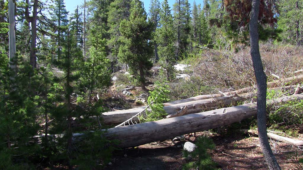
A bit later I reached the third downed tree, too large to crawl over. Others had made a path up and over the roots. I looked at this obstacle and considered my situation. I was by myself, the mine was a good half mile away, and there might be more downed trees. If I needed to reach the mine, I could try the route from Foresthill Divide through Dorer Ranch. I considered everything, and decided to have lunch at my gold panning spot.


View from the trail to my gold panning spot

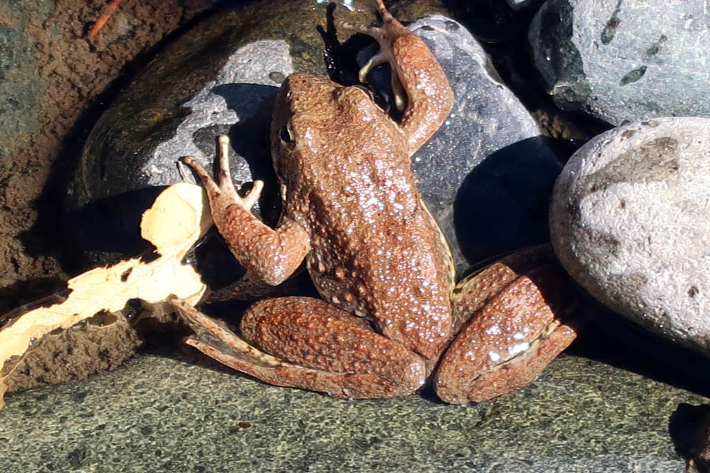
The river was at the lowest level I had ever seen, a good two feet below normal judging from the moss on the rocks. I'll return soon with a bucket, shovel, and gold pan, but today I simply enjoyed the scenery. Small trout rose to the surface. Frogs hopped about. During spring snow melts, in years without drought, I've seen the river running so hard that getting caught in the current meant certain death, and I've heard the clunk of boulders the size of basketballs moving downstream. But today I could have crossed the river without getting my knees wet. I finished my lunch and poked around the bar. People camp here. Someone had left behind a piece of quartz taken from a nearby vein. I'm sure they had taken several pieces, but left this one as it contained so little gold it was not worth carrying out of the canyon. I left the rock, so that others could find it and see the gold. Also at the bar was the rusted wheel of an ore cart from some mine around here.


Gold-bearing quartz

I wonder if this is where Thomas Lane met his end. From the Daily Alta California of July 2, 1855:


I made the 1800 foot ascent without needing to stop and rest. I did briefly talk with two men in their thirties hiking down to the river, the only others I saw on the trail this day. They didn't intend to go beyond the bridge. Few people do. Here may be the reason the trail from Iron Point to the river is well maintained, while the section from the river to Dorer Ranch is blocked with downed trees - it's a matter of use. Or maybe the Forest Service doesn't have the staffing or funds to remove those large trees. (The Forest Service website says that no trail maintenance has been done since 2013.) Perhaps it's intentional neglect. This is a designated Wild and Scenic River, and since few use the section of trail, why not let it revert to its wild state?

Tuesday, April 14, 2015

Yankee Jim's Road

"Have I been down this road before?"

The question came to mind while braking my Ford F150 pickup truck in low gear as I wound down the narrow primitive road named Yankee Jim's. The Colfax and Forest Hill Commercial Toll Road Company carved this route through the Sierra canyons in the early 1880s. Colfax was a railroad town and Foresthill was a mining community. Yankee Jim's was a mining town on the road, near Foresthill. The toll booth at the North Fork American River crossing closed in 1906 when Placer County bought the route. The current bridge dates to 1930 and is in poor shape.

Yankee Jim, by the way, was a gold prospector and horse thief. He left his eponymous town and continued his horse thieving ways in southern California, where he ended his days at the end of a rope.

My passenger Gary is a fellow member of the Sierra Foothills Amateur Radio club. Recently finding a shared interest in gold panning, we decided to do some prospecting together, starting with today's scouting trip. Gary had last been on Yankee Jim's Road many years ago and thought it was worth a try.

Four roads go over the North Fork. The crossing furthest downstream and the most traveled is Highway 49, which follows the Mother Lode. Next is Ponderosa Road, built by the Civilian Conservation Corps during the Great Depression. Then comes Yankee Jim's Road. The fourth, higher into the Sierra, is Iowa Hill Road, built during the Gold Rush on a precipitous route, the most exciting ride in the county. Beyond that, the canyon walls become too rugged for roads, with only foot paths reaching the river, and few even then.

I've driven the other roads but I couldn't remember if I'd ever been on Yankee Jim's. It seemed familiar but I wasn't sure. The road from Colfax to the river was in good enough shape. This section was once paved but now it's gravel over a slate base. Attention is needed with all the curves. Some drivers don't pay attention and over the side they go. Rare, but it does happen: a quick Google search provided a recent account (link here) of a tow truck pulling a Honda from the North Fork just below Yankee Jim's Bridge. Since I paid attention we easily reached the old bridge without incident.

The next turn-around after the bridge was a mile and a half away. We didn't know this, nor did we know that the most interesting section of road was just ahead.

The grade increased. Clearance on both sides narrowed to a few feet. The canyon dropped steeply to Shirttail Creek some one hundred fifty feet below. These factors by themselves meant only increased attention was needed for the ascent; but, with the dirt and gravel surface slick from the rain two days before, and the road getting more uneven, the prospects for continuing in my two-wheel drive truck were not good. Should we proceed, when the road could be even worse beyond the bend? I didn't want to get stuck - the tow would cost more than what my 18-year-old truck was worth. Sliding off the road was the worst scenario: I pictured my crumpled truck resting upside down at the bottom of the ravine, with Gary and me trapped inside as the waters of Shirttail Creek filled the cab. Backing the truck one-third mile to the bridge would be slow and difficult. Right now this rugged canyon country didn't look so charming.

We decided that Gary would walk the road ahead to check conditions. He had to squeeze out of the cab, for the canyon wall partially blocked the door. We programmed a simplex frequency into our two-meter handheld radios. Gary disappeared around the bend. Reports came that the road was improving. After some ten minutes he told me to proceed, that he had reached a road crew. I started the truck, put it in low gear, released the parking brake, and gave it the gas. My truck kept its traction on the area of concern.

I reached Gary and the road crew, two men with a grader and a truck, at a bend where my truck could pass. We spoke with the two for a few minutes, and then we continued. I drove slowly over the freshly-graded dirt to maintain traction. The travel was fine. We reached Mexican Gulch, at the turnoff to Shirttail Creek Road, and worked a few pans of gravel. After finding only a few small specks of gold, nothing of interest, we continued on to Yankee Jim's. In the early years of the Gold Rush this was one of the largest communities in Placer County. Now only a few people live here. The place seemed vaguely familiar. I asked myself again if I had been up Yankee Jim's Road before. I really couldn't tell. We drove to Foresthill and exited the historic toll road.

----

That journey was on Thursday, April 9. I wanted to get a better idea of the road, one that would come only from a walk, so I returned to Yankee Jim's Road by myself on Monday, April 13.


I approached Yankee Jim's Road from the Colfax side, and parked next to where the pavement ends and the primitive road begins. The bridge was 3.5 miles away. The elevation here is 1875 feet. I started the walk down Bunch Canyon a few minutes after nine o'clock.


Posted signs tell the traveler not to stray beyond the road. Such notices in these parts, where a frontier mentality persists, are best heeded.


Reaching a long section of fence, I peered between the slats and saw an old and decrepit house below. I'm not sure if anyone lived in it.


I reached the boundary of Auburn State Recreation Area, beyond which came beautiful scenery.


The twisted and tortured rocks I passed were formed by subduction. This is the Calaveras complex. The rocks get older towards the river. I began my walk along slates from the Jurassic, passed the Gillis Hill Fault, walked by ultramafic rocks from the Triassic, and finally reached metavolcanic rocks from the Permian. Alt and Hyndman's Roadside Geology of Northern and Central California (2000) states:
The best that can be said of the Calaveras complex rocks is that they are an unholy mess, difficult to decipher in the field and impossible to describe adequately on maps or in words. The rocks include a scrambled assortment of pieces of old oceanic crust and sediments that were deposited on them, all torn up along faults, jammed into tight folds, and recrystallized into metamorphic rocks in the heat of the deep trench. Even geologists experienced in working with such rocks find it hard to stop at an outcrop and understand what they see.
Within this unholy mess formed quartz veins with gold. I passed the adits of several abandoned mines, all sealed now for safety.


More beautiful scenery. Plus, the golden poppies were in bloom.


The North Fork American River came into view.

A small landslide, likely caused by the rainstorm the previous week, partially covered the road.


I approached the bridge. A female park ranger was removing fee payments from the collection box. I reached the bridge at 11:03, after a walk of two hours. The elevation was 930 feet, so I had descended 945 feet in 3.5 miles.


After crossing the bridge I met the same grading crew from the past Thursday. They had finished their grading to the bridge and were preparing for their return to Foresthill. They remembered my truck.


I walked one-third mile to the spot where we stopped on Thursday, for Gary to get out and scout the road ahead. The coordinates were 10N 681911 4323045, elevation 1092 feet. I took a photo of the spot and the drop to the creek below.


I turned around and walked back to the truck, reaching it shortly after one o'clock. The hike had lasted four hours. I covered 7.6 miles.

I had seen only nine other people: 1) A man in his fifties on a mountain bike, and his dog, coming up from the bridge; 2) A county worker in a truck headed to the bridge; 3) A female park ranger headed to the bridge; 4 and 5) The grading crew across the bridge, with truck and grader; 6) A male park ranger approaching the bridge from Foresthill; 7) A man in a privately-owned truck approaching the bridge from Foresthill; 8 and 9) A couple in an SUV headed to the bridge from Colfax.

There's history and scenery on Yankee Jim's Road. If the road conditions are bad, there's also an interesting ride. Avoid the road after a rain due to the slick conditions. With two-wheel drive, wait until after the road graders repair all wear from the winter. Keep a close eye on the road. Pray that you don't meet an oncoming vehicle, for there are long stretches where only one vehicle can fit.

I'm looking forward to my next drive down Yankee Jim's Road to the North Fork American River, this time with my gold panning gear.

Friday, May 24, 2013

The Lava Tubes

"Descend, bold traveler, into the crater of the jokul of Sneffels,
which the shadow of Scartaris touches before the kalends of July, and
you will attain the centre of the earth; which I have done, Arne
Saknussemm." - Jules Verne, Journey to the Center of the Earth

The hike starts normal enough. A well defined path, some rocky spots requiring attentive footwork. But soon you're walking stooped over. You see optional routes. Which one to choose? You're stooping even more, until you're moving forward on hands and knees. More routes are offered. If you're really adventurous, you choose a route where you crawl on your belly. You're in a lava tube. Most likely a maze of tubes. Stay low so you don't bump your head. Remember your route because it's easy to become disoriented - you may be going further into the tube when you think you're heading out. And if you're hiking alone, bring spare light sources, because inside a lava tube it's very, very dark.


The tube began with the eruption of a volcano. The lava flowed downhill. Here and there the sides and top of the flow solidified while the lava inside continued to flow. The eruption ended and the lava ran out, leaving an empty space behind it - the tube. Or, the maze of tubes, as the flows moved in and out of each other, or branched off on their own.

Time passes. The volcano erupts again. The lava tube creation process begins anew. A new level of lava tubes rests atop the previous. The volcano erupts again and again. The landscape becomes honeycombed with lava tubes. One day the roof of a lava tube on the uppermost layer gives way, the rocks hitting the floor in a thunderous crash, and sunlight enters.

Lava Beds National Monument in Northern California contains the largest concentration of lava tubes in North America - more than 700 discovered caves, of which 22 are developed for hiking. The area contains such a variety of igneous features that it attracts geology students (and those with an amateur interest in geology) from far and wide. The lava flows played a role in history. In the 1870s, the Modoc Indians retreated from the Army to this natural fortress. Today one can walk the sites of the Modoc War: where the Army laid siege to the Modoc warriors and their families; where the Modocs almost wiped out an Army patrol; and where the only general in the Indian Wars was killed.

The volcanic activity comes from subduction. The Juan de Fuca and Gorda oceanic plates are sliding under the lighter continental plate. The subduction is creating the Cascade Range which runs from Northern California to British Columbia. (The same subduction process, from a different oceanic plate long ago, created the ancestral Sierra and the granitic plutons of the modern Sierra.) Northern California has several active volcanoes. In my teens I met an elderly man from Tehama County who saw the 1915 eruption of Mount Lassen. The flows in Lava Beds National Monument come from Medicine Lake Volcano to the south. Medicine Lake Volcano, a shield volcano built up one eruption at a time, is the largest volcano in the Cascade Range. An eruption about 1,000 years ago formed Glass Mountain. Yes, a mountain of glass - a massive flow of pumice with large blocks of obsidian. Years ago I walked at the edge of its barren and crunchy surface. Eruptions around Medicine Lake Volcano will continue. The lava tubes so popular with tourists will someday be covered with another layer of lava.

Lava Beds National Monument was created in 1925. During the Depression, the Civilian Conservation Corps developed most of the trails used today. The area had plenty of visitors before this. These visitors did things that would make any park ranger cringe. They dropped rocks and garbage down the Fleener Chimneys vents just to see how far they would fall, until the vents were filled. They removed war artifacts from the battlefields and the grounds where the Modocs stayed under siege. They broke formations off the walls and ceilings of the lava tubes. Today the Park Service rangers enforce the rules that help give the Monument a somewhat primitive feel despite the number of visitors.

I went this past week, in the off season, before school lets out and vacationing families will come in. Many sites in Indian Well Campground were unoccupied.

Oftentimes I was the only person inside a lava tube. I was curious about people getting lost in a lava tube, or stuck in a tight spot. Upon my return I emailed a query to a park ranger about this. Here was the response:

"It is very rare that Lava Beds Rangers have to conduct search and rescue operations in the park. I am not aware of any incidents in which a visitor got stuck nor one in which all light sources failed. Occasionally visitors have difficulty navigating some of the more complex caves (Golden Dome Cave, Labyrinth/Lava Brook Cave System, Hercules Leg/Juniper Cave System). However, they typically find their way out after no more than an hour or two, either on their own or with the help of other visitors. There have been a few instances in which visitors have been lost for an extended period of time (up to 36 hours). Theses incidents have only occurred in Catacombs Cave, by far the most challenging developed cave in the monument."

I did a little more research and found this newspaper article about two school girls lost in Catacombs Cave for more than 27 hours in 2004.

I know how easy it is to get turned around in the maze of tubes. On this trip, I got bewildered in two lava tubes. On a trip many years ago I was hiking out of a tube, only to encounter two others heading towards me who were hiking out of the tube. I had gotten myself turned around and was actually hiking into the tube. And I must admit that, five minutes after realizing I was disoriented alone in a tube, I've had that little bell go off in my head, that "uh-oh" thought.

(Maps of the developed tubes are sold in the Visitor Center, but a map would take the adventure out of my exploration.)

And there are the low spots. On this trip I didn't go anywhere requiring more than a deep crouch. But years ago, in what tube I can't remember, I was walking along, the ceiling getting lower and lower, the walls perhaps fifteen feet apart, until I reached an area where the ceiling height was slightly under waist level. Not a tight squeeze by lava tube standards, with some openings one foot high. I shined my flashlight down the tube. I saw that the ceiling remained at this height for some twenty feet, and then it rose to where I could walk upright. The floor of the tube was smooth. I removed my daypack and got on my belly. I cradled the daypack strap in one elbow while holding my flashlight in my other hand, and I crawled through that opening. The ceiling rose and soon I was upright, and I continued on. I did this alone. I don't think anyone else was in the tube.

Those with the proper training and equipment take on the undeveloped lava tubes. For us casual visitors, the developed tubes in Lava Beds National Monument offer a pleasant little adventure.

Natural Bridge Cave, with my truck

Sunshine Cave

A small opening in Hercules Leg Cave

Balcony Cave

Boulevard Cave, another small opening


Saturday, May 11, 2013

Loch Leven Trail


Temperatures in the nineties in the Sacramento Valley are driving hikers to higher elevations in the Sierra. Today I hiked a very popular trail, the Loch Leven Trail, which starts near Interstate 80, at an elevation of 5,680 feet. I arrived early, before eight o'clock, to avoid the crowds, and only a few vehicles were in the small parking lot. When I returned a few hours later, the lot was full and vehicles were parked in any available space nearby.

The trail was covered in snow just a few weeks ago. Patches of snow were still about. Water from snowmelt ran down some sections of the trail. Several large trees felled by the weight of snow over the winter lay across the trail. They will eventually be cleared.

The elevation gain is only 1,070 feet. The rocks and tree roots on the trail add some difficulty to the hike, particularly on the descent. There is a bit of scrambling in places. A hiking staff helps with stability.

The geology is interesting. The trail crosses the boundary between two rocks. The rock in the Rattlesnake Creek Pluton is granodiorite, a relative of granite, and is 120 million years old. This rock intruded as magma into the older Jurassic volcanic arc rock (Early Jurassic, about 200 million years old) during a subduction process. This pluton was essentially a large blob of molten rock that moved upward from the subduction zone far below. The magma followed fractures and melted overlying rock. Some magma reached the surface and erupted as volcanoes. But most stayed five to ten miles underground in a large chamber, and slowly cooled to leave the crystals in the rock we see today.


Where I stood on the granodiorite, the rock went several miles below me, and it once went several miles overhead. What eroded came to rest in what is now the Sacramento Valley.

There is no distinct line between the Cretaceous granodiorite and the Jurassic terrane rock. The two slowly melded together until one gave way to the other.

I continued up the trail, crossing the railroad tracks, the original ones being built by the Chinese for the Transcontinental Railroad. Further up I encountered snow. I scrambled about trees fallen across the trail. I passed granodiorite outcrops polished and scraped by glaciers. I passed the first two Loch Leven lakes and had lunch at the third.


A wonderful day in the Sierra.

Thursday, August 16, 2012

Creation Evidence Museum

While in Texas visiting family, our travels took us to the small town of Glen Rose, about one hour southeast of Fort Worth. Dinosaur footprints found in the nearby Paluxy riverbed led to the establishment of Dinosaur Valley State Park. But wait, there's much much more! In the 1930s human footprints were found alongside the dinosaur footprints! They of course were not left in place, but instead were dug up to show others. The story is told in the Creation Evidence Museum outside Glen Rose. Go to their website if you dare. The human footprints prove that Charles Darwin got it all wrong with that evolution stuff. Dinosaurs and man coexisted! Every word of Genesis is true, and Earth is only about six thousand years old. All those layers of fossils? Caused by the Flood! The geologic doctrine of Uniformitarianism? Never heard of that!


Fortunately, time constraints prevented us from taking the tour, leaving the five dollar admission fee to be better spent at Rahr & Sons Brewery in Fort Worth.